REVIEW · AUCKLAND
Auckland: 36 min scenic helicopter flight – Coast to Coast
Book on GetYourGuide →Operated by INFLITE Mt Cook Ski Planes & Helicopters · Bookable on GetYourGuide
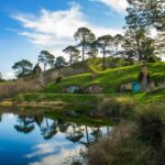
Auckland from above hits different. In one flight, you get the rugged West Coast and the city core in a way no road trip can match. I love how the route feels like a real aerial “tour of Auckland,” with sharp changes in scenery—surf-pounded coast, volcanic rock, then straight into downtown views.
Two things I really like: the pilot live commentary that helps you make sense of what you’re seeing, and the fact the scenery covers both “wild” and “iconic” Auckland in about half an hour. One consideration: these flights are weather dependent, so your date/time matters, and helicopters also have weight limits.
Small group usually means you’ll get the view without the chaos. This one is limited to 7 participants, and you’ll be watching landmarks like Sky Tower and the Harbour Bridge from the air while also getting the quieter drama of the Waitakere Ranges and Rangitoto.
In This Review
- Key things to know before you fly
- A coast-to-coast aerial route that actually fits 30 minutes
- From Albany out toward Bethells (Te Henga): black sand and volcanic rock
- Waitakere Ranges and Manukau Harbour: the wild side behind Auckland
- Over downtown: Sky Tower, Viaduct Harbour, and Harbour Bridge geometry
- Devonport to North Head, then Rangitoto’s crater from above
- Price and logistics: what $358 buys you (and what to watch)
- Weather reality: when your view quality can change fast
- Who this flight is best for
- Should you book the Auckland Coast to Coast helicopter flight?
- FAQ
- How long is the helicopter flight?
- What sights will I see during the flight?
- Is it a small group tour?
- Is there a minimum number of passengers?
- Does the flight include commentary?
- Are there weight limits?
- Are drones or flash photography allowed?
- Can I cancel and get a refund?
Key things to know before you fly
- Black sand + volcanic cliffs at Bethells (Te Henga) Beach from above
- Waitakere Ranges views, plus hidden water reservoirs
- Auckland’s Downtown, Viaduct Harbour, Sky Tower, and Harbour Bridge from the sky
- Devonport Naval Base, North Head, and the Rangitoto Island crater
- Small group size (limited to 7), so the experience stays personal
A coast-to-coast aerial route that actually fits 30 minutes
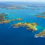
This helicopter flight is designed for people who want the big picture fast. You’re not spending the day bouncing between stops. Instead, you get a single continuous loop that starts near the city, swings out to the West Coast, then comes back over the central skyline and finishes with Rangitoto.
The payoff is in the contrast. From the air, Auckland doesn’t look like one city—it looks like a set of very different worlds packed close together. You’ll see surf-pounded coast and jagged volcanic rock, then glide over dense urban geometry, then end with volcanic terrain at Rangitoto’s crater.
Also, because it’s a helicopter, the “where are we?” question mostly disappears. You can track the route by following coastlines and harbours visually, which makes the time feel tighter—in a good way.
You can also read our reviews of more tours and experiences in Auckland
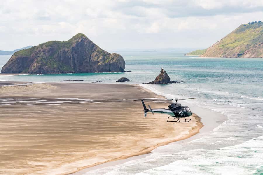
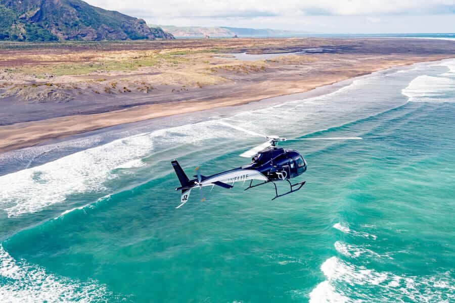
From Albany out toward Bethells (Te Henga): black sand and volcanic rock
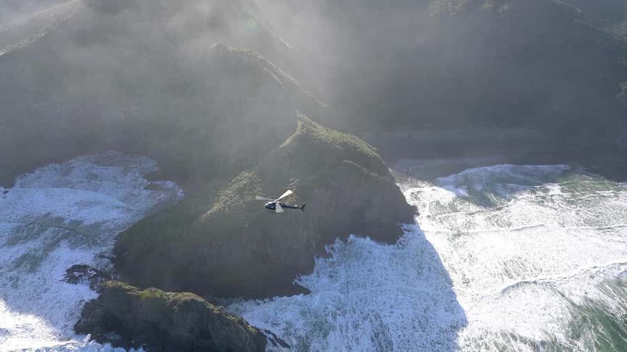
You start out flying from Albany, heading over Kumeu and Huapai. That early section matters because it sets up the contrast you’ll feel later—urban-edge to wild coast—without you having to do anything except look out the window.
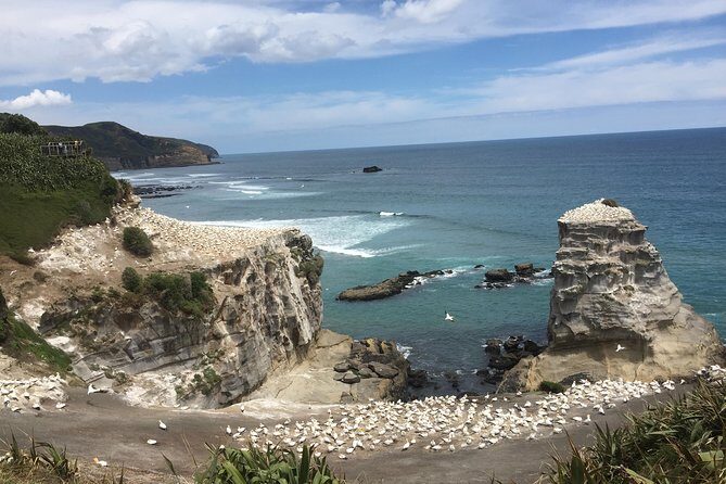
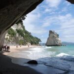
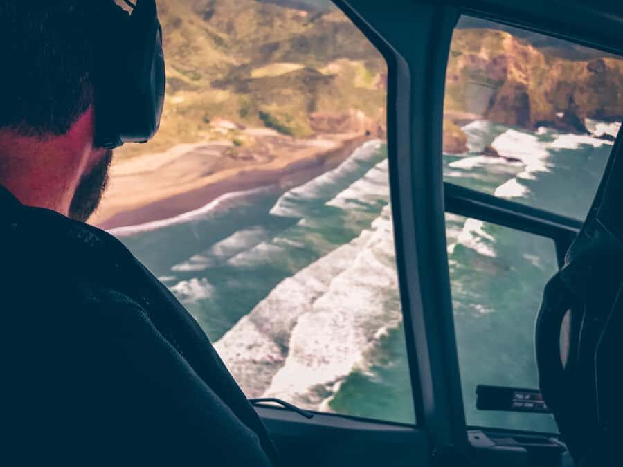
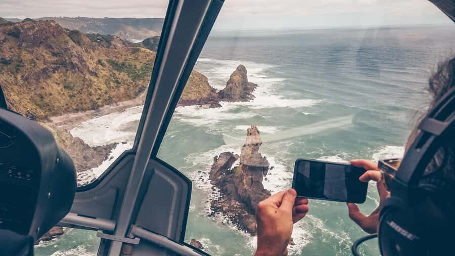
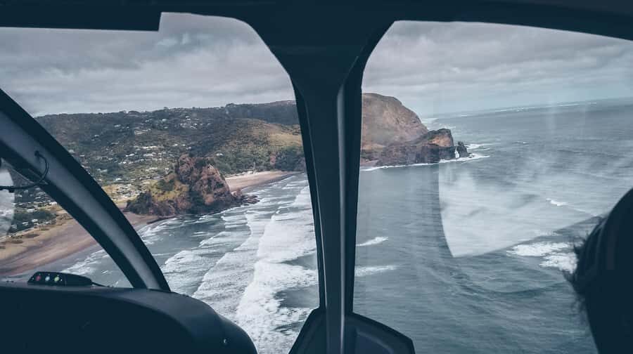
Then you reach Bethells (Te Henga) Beach, where the scenery turns dramatic. From the air, the West Coast’s black sand and the volcanic cliffs are easier to read as a whole system: beaches, rocks, caves, and the way the coastline bends under incoming surf. The route follows the coast south after Bethells, which helps you see the shape and texture of the shoreline rather than only a single “photo moment.”
Here’s the practical angle: this is where aerial views can be more valuable than ground views. On foot, you may get angles blocked by cliffs and vegetation. From above, you can see the full line of the coast and spot where rock outcrops carve small pockets and caves into the cliffs.
If you’re the type who likes landscapes you can understand at a glance—where you can visually connect ocean, rock, and beach—this leg is the heart of the tour.
Waitakere Ranges and Manukau Harbour: the wild side behind Auckland
After Bethells, the flight shifts to the Waitakere Ranges. You’ll fly over the bush-clad ridges and also notice the water reservoirs tucked within the area. That detail is a nice reminder that Auckland’s “wild” isn’t just aesthetic—it’s infrastructure and geography at the same time.
This part of the route is about getting a sense of Auckland’s scale. The city grows fast on the map, but from the air you can see how much green and rugged terrain sits between suburbs and coastline. It’s one of the easiest ways to understand why Auckland feels like it has a permanent edge of nature.
As you continue, you head almost to the mouth of Manukau Harbour, where the flight leaves the more familiar coastal city feel and leans into the feeling of a remote, older New Zealand. You’re not landing anywhere; you’re moving through layers of terrain quickly. That’s a drawback for people who want lots of time on the ground—but it’s also the reason this tour fits.
One more thing: helicopters are weight- and weather-sensitive. If conditions affect flight paths, the exact angles you see over ranges and harbours can vary. Even so, the overall “west side to city side” arc is the point.
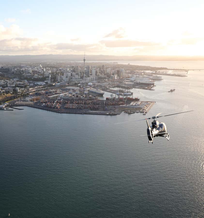
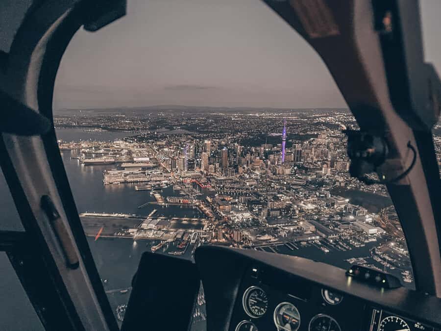
Over downtown: Sky Tower, Viaduct Harbour, and Harbour Bridge geometry
Then you start coming back toward the city. The route takes you over Downtown Auckland and Viaduct Harbour, and you’ll pass prominent spots like Sky Tower and the Harbour Bridge from above.
What you’ll notice is how the city landmarks line up like they’re part of one big layout. From street level, you can’t always get spatial context—what’s near what, or how harbour shape affects the skyline. From a helicopter, it becomes obvious: harbours funnel movement, bridges connect zones, and the skyline sits right on top of it all.
This is also a great moment if you’re into photography, but with one limitation: flash photography isn’t allowed. Plan on normal photo settings and let the light do its job.
The city leg also works as a breather. After volcanic cliffs and rugged coast, the urban area is clean and geometric. Your eyes get a different kind of stimulation, which helps the flight feel varied instead of repetitive.
Devonport to North Head, then Rangitoto’s crater from above
From the central harbour area, the route tracks across Waitemata Harbour toward the Devonport Naval Base and North Head. Even if you’re not a military history person, these aerial views are useful because you can spot the shape of the coastline and how the headland protects and frames the harbour.
The grand finale is Rangitoto Island. You’ll fly out to view the crater, which is the kind of natural feature that looks like a diagram from the air. Ground-level views can be dramatic, but seeing the crater form from above gives you a different understanding of scale and origin.
Then you return to the heliport. The whole loop is set up so your final mental image is not “a random Auckland view,” but a clear ending point: volcanic crater, harbour edges, and coastal terrain all tied together.
This ending matters for celebration types, too. If you’re planning a birthday, anniversary, or proposal, finishing with Rangitoto’s crater gives you a memorable visual climax rather than a quiet fade-out.


Price and logistics: what $358 buys you (and what to watch)
The price listed is $358 per person for a flight described as about 36 minutes scenic with a scheduled 30-minute duration. In plain terms: you’re paying for the fact that this is a fast aerial overview that covers multiple major regions without time lost to driving.
So is it value? For me, the value comes from the route coverage. You’re getting:
- West Coast black sand and volcanic cliffs
- Waitakere Ranges with reservoirs
- A sweep over downtown and harbour icons
- Devonport, North Head
- Rangitoto crater
If you were to recreate those views by car and viewpoints, you’d spend far longer, and you’d still miss the “whole picture” effect helicopters provide.
Now the limitations you should take seriously:
- Weight limits apply on all flights, and the tour isn’t suitable if you’re over 264 lbs (120 kg).
- Flights are heavily weather dependant, which can affect timing.
- There’s a minimum of 2 passengers to confirm a booking.
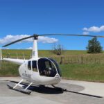
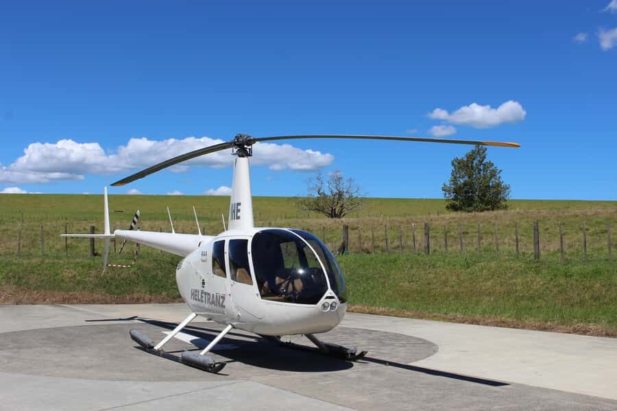
- Your exact helicopter type can vary based on passenger numbers and availability (for smaller groups, a Robinson R444-7 is mentioned; for larger groups, jet-turbine helicopters like AS350/355 Squirrel, Airbus EC130, Bell 427, or AW109s may be used).
Also, plan for what you bring. Oversize luggage isn’t allowed, and the flight has a clear no-go list including drones and flash photography, plus no smoking and no intoxication.
These rules aren’t there to be fussy. In a small helicopter cabin, restrictions protect comfort, safety, and cleanup time—so your flight runs as smoothly as possible.
Weather reality: when your view quality can change fast
Because flights are weather dependant, the biggest risk isn’t the company—it’s the sky. Cloud cover, wind, and visibility can determine how a route looks from the air.
Here’s the practical approach: be flexible about your preferred time window. The flight notes that scenic flights generally run in the morning or afternoon, and date/time availability is confirmed based on what’s workable.
Also, remember you’re viewing multiple regions in one loop. That means the “look” of the flight depends on light and clarity across several areas—West Coast surf, volcanic cliffs, harbour water, and Rangitoto. If visibility is limited, you might still get the route, but the crispness of details like caves or crater edges can change.
Who this flight is best for
This works best for:
- People who want a high-impact overview of Auckland without spending hours in transit
- Anyone who loves variety—city icons and rugged coastline in one ticket
- Celebration travelers who want a setting that feels special and personal, not staged
- First-timers to Auckland who want a sense of where everything sits relative to the harbours
It’s less ideal if:
- You dislike time-limited experiences and want long ground time
- You’re sensitive to weather changes
- You’re over the 264 lbs (120 kg) limit
Should you book the Auckland Coast to Coast helicopter flight?
If your goal is to see Auckland’s West Coast drama and the city’s best-known skyline icons in one go, yes, book it—especially if you like aerial views that make geography instantly understandable.
I’d skip it only if you’re unlikely to be flexible with timing due to weather, or if you’d feel frustrated knowing it’s a short loop rather than a long on-the-ground tour. The cabin experience depends on conditions, and the best moments come when the sky is cooperative.
One final tip: treat this as a “get your bearings fast” flight. You’ll come away with a mental map of Auckland—West Coast to downtown to Rangitoto—that makes the rest of your trip easier and more rewarding.
FAQ
How long is the helicopter flight?
The experience lists a 30-minute duration, with a 36-minute scenic flight described for the route.
What sights will I see during the flight?
You’ll fly over Auckland’s West Coast, the Waitakere Ranges, Bethells (Te Henga) Beach, and then over the central city including Sky Tower and Viaduct Harbour. You’ll also see Waitemata Harbour, Devonport Naval Base, North Head, and Rangitoto Island’s crater.
Is it a small group tour?
Yes. It’s limited to 7 participants.
Is there a minimum number of passengers?
Yes. A minimum of 2 pax is required to confirm the booking.
Does the flight include commentary?
Yes. You get detailed commentary from an expert pilot (English).
Are there weight limits?
Yes. The tour is not suitable for people over 264 lbs (120 kg), and weight limitations apply to all flights.
Are drones or flash photography allowed?
No. Drones aren’t allowed, and flash photography isn’t allowed.
Can I cancel and get a refund?
Yes. You can cancel up to 24 hours in advance for a full refund.