REVIEW · AUCKLAND
Auckland: Auckland City & Hauraki Gulf Scenic Flight
Book on GetYourGuide →Operated by Waiheke Wings · Bookable on GetYourGuide
A 45-minute flight can feel like a whole day of sightseeing. This one strings together Waiheke Island, the Hauraki Gulf, and Auckland’s top landmarks in a tight loop, with English commentary so you’re not just looking out a window. I love that it’s long enough to make the route meaningful (islands to city to volcano), and I also like the photo opportunities like the Sky Tower pass. The main drawback is simple: weather controls whether you fly, so you’ll want flexibility in your schedule.
Here’s the big idea: you get a clear aerial “map” of how the islands and the city fit together. That’s rare in Auckland, where most tours keep you on the ground and you lose the scale. You’ll be in a small group of up to 9, which helps the ride stay calm and makes the commentary easier to follow.
One more thing I appreciate is how practical it is. You can plan around a fixed flight length of 45 minutes, you’ll know what you’ll see (Sky Tower, Harbour Bridge, Rangitoto crater), and the provider plans for you to arrive early for a safety briefing. Still, you’ll need to pack light and skip selfie sticks.
In This Review
- Key things to notice before you go
- Why a 45-minute sky loop makes sense in Auckland
- Waiheke takeoff: vineyards, coastline, and fast orientation
- Hauraki Gulf islands en route to Auckland’s center
- Sky Tower half-orbit: the photo pass you’ll actually use
- Harbour Bridge, Davenport Naval Base, and North Head views
- Rangitoto crater: the “500 feet above the summit” moment
- What the experience feels like in the small plane cabin
- Price and value: is $178 worth it?
- Booking smart: when to schedule your flight
- What to bring (and what to leave behind)
- Who this Auckland flight is best for
- Should you book this scenic flight?
- FAQ
- How long is the Auckland City & Hauraki Gulf Scenic Flight?
- How much does it cost?
- What’s included in the ticket price?
- What should I bring?
- Are food and drinks included?
- Where is the meeting point?
- What items aren’t allowed?
- What’s the group size?
- What happens if weather cancels the flight?
- Can I cancel for a refund?
Key things to notice before you go
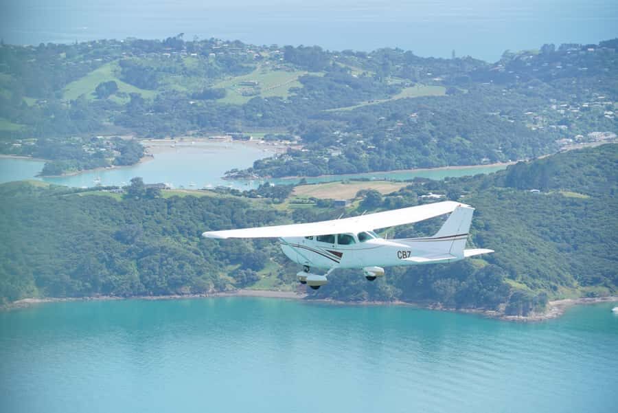
- Waiheke Airport departure: your scenic route starts right where the island’s vineyards and coastline come into view.
- Islands-to-city sightline: you’ll pass Motuhie and Browns Islands before cruising over downtown Auckland.
- Sky Tower half-orbit: you get time for photos from above, not just a quick flyby.
- Volcano crater moment: you’ll peer into Rangitoto’s crater from about 500 feet (152 meters) above the summit.
- Small group of 9: the cabin stays comfortable and the English commentary is easier to hear.
- Weather-dependent ops: if conditions aren’t right, flights get rolled to the next available day.
Why a 45-minute sky loop makes sense in Auckland
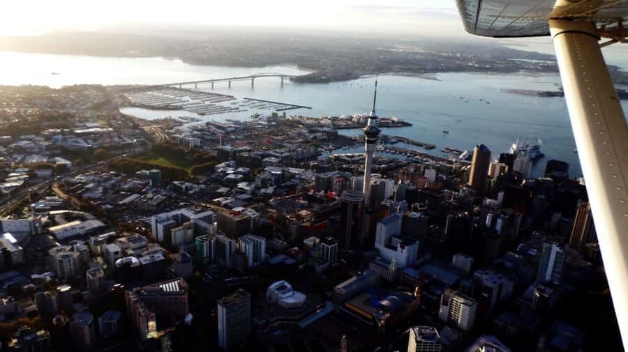
If your time in Auckland is tight, this flight is the quick win. You’re not hunting for viewpoints, driving a long loop, or waiting for traffic. Instead, you get a structured route that hits both the water-world of the Hauraki Gulf and the city icons of Auckland.
I especially like that the route isn’t random. You move logically from the island scenery to Auckland, then to the volcanic centerpiece at Rangitoto. That sequence helps you understand what you’re seeing—how the gulf islands sit against the urban skyline.
The tradeoff is that you’re locked into the fixed duration. At 45 minutes, there’s no “linger and enjoy” option if you get stuck in a patch of cloud. You’ll still get the key sights, but you should come in expecting a fast, scenic overview.
You can also read our reviews of more city tours in Auckland
Waiheke takeoff: vineyards, coastline, and fast orientation
The flight starts at Waiheke Airport, and that matters more than you might think. You lift off right among the island’s wine country, so the first minutes already feel like you’re in the heart of Waiheke rather than an industrial edge.
Soon after takeoff, you follow the island’s coastline, beaches, and vineyards. This is where the aerial view does the most work for you: you can trace the curves of bays and see how the beaches sit relative to the inland slopes. If you’ve been walking around Waiheke on foot, you’ll use this to connect neighborhoods to geography.
From here, the route tracks along the water before breaking off toward Auckland. That transition is fun because it shows the gulf as a system, not separate postcards. You’ll also get a chance to spot how coastline turns into island-to-island open water.
Hauraki Gulf islands en route to Auckland’s center
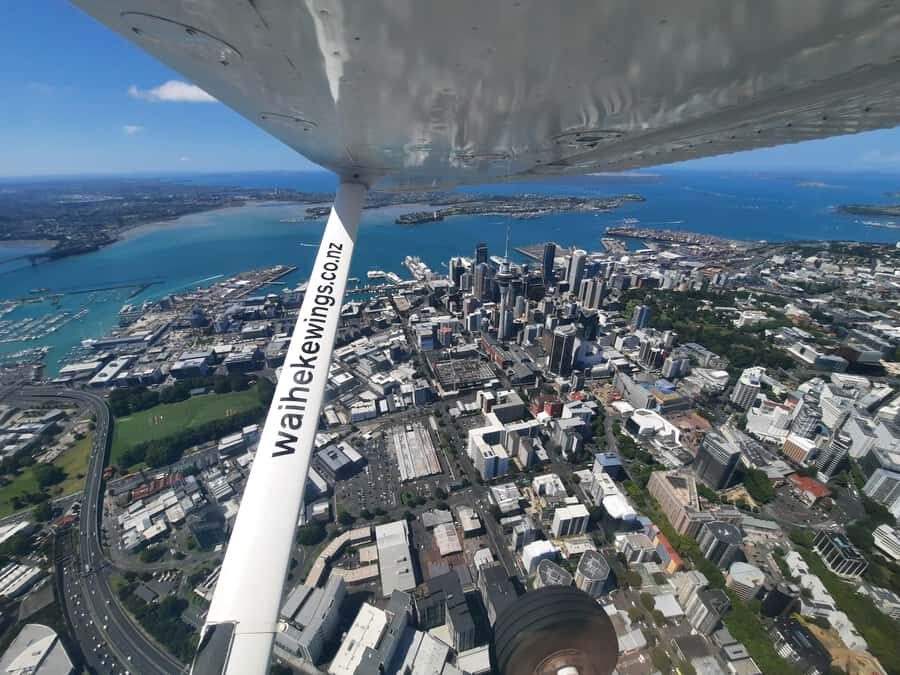
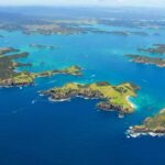
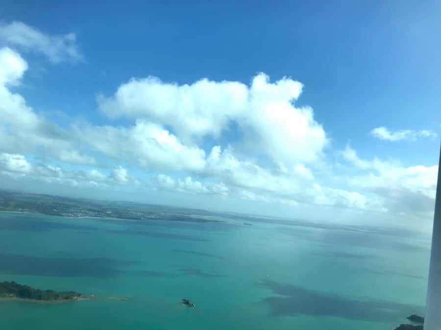
One of my favorite parts of this flight is the stretch where you’re flying over the gulf rather than the city. Before you reach Auckland, you can admire Motuhie and Browns Islands from above. Seeing these small islands from the air gives you scale fast—everything looks closer and smaller than it does on a ferry schedule.
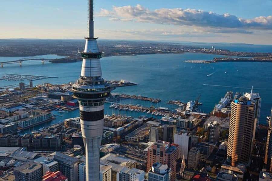
Then you cruise past downtown Auckland. From the sky, the “shape” of the city makes more sense: how waterfront edges meet built-up areas, and where the skyline rises against the bay. You’re not just collecting sights; you’re learning the layout.
Aerial routes like this can be hard to get on the ground. So if you want the gulf-and-city combo in one go, this flight is one of the most efficient ways to do it.
Sky Tower half-orbit: the photo pass you’ll actually use
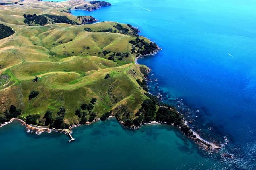
A lot of city tours offer landmarks. This one sets up time for one landmark that most visitors actually try to photograph: Sky Tower. You’ll fly past and then enjoy a half-orbit of the Sky Tower, giving you multiple angles as you circle.
That matters because angles change everything with towers. From the street, you’re limited by nearby buildings. From the air, you can capture the tower with the surrounding skyline and the harbor context in the same frame.
I also like that the timing feels built-in rather than rushed. You’re not just glancing at it for a second while the pilot moves on. You have that short orbit to steady your phone or camera and get your preferred perspective.
Harbour Bridge, Davenport Naval Base, and North Head views

After the Sky Tower segment, the route turns toward more recognizable Auckland icons and coastlines. You’ll fly past the Harbour Bridge, Davenport Naval Base, and North Head Volcano.
From the air, the Harbour Bridge looks like a clean line across water instead of a single roadside landmark. You also get context for why Auckland’s harbor feels so central: the city edges, bridge span, and lookout points all line up in a way you can’t easily appreciate from street level.
North Head Volcano is another good example of what aerial views do best. The point of seeing it from above is that you can interpret it visually as part of the broader volcanic story in the region. You’ll start to connect this with what comes next.
As for Davenport Naval Base, it’s the kind of place you’ll probably never fully understand just by looking at it from a distance on foot. The flight gives you a clearer sense of how it sits along the coast.





Rangitoto crater: the “500 feet above the summit” moment
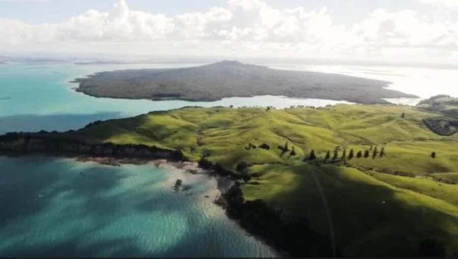
Then you reach Rangitoto, New Zealand’s youngest volcano. You’ll see it from above, and the highlight is getting a look into its crater from about 500 feet (152 meters) above the summit.
This is the moment that makes a scenic flight feel different from a generic sightseeing flight. You’re not just seeing a volcano as a shape; you’re getting the crater viewpoint. Even if you’re not a geology person, the aerial angle helps you understand why Rangitoto is such a defining feature of the Hauraki Gulf.
The practical bonus: the flight keeps the volcano segment close to the end, so you’re less likely to be distracted by hunger or fatigue. You’ll still be on the clock, but the route saves its most dramatic visual for later.
And yes, the weather can add drama. One verified passenger specifically mentioned seeing a beautiful rainbow, which is a good reminder that sky conditions can turn an already scenic route into a memorable one.
What the experience feels like in the small plane cabin
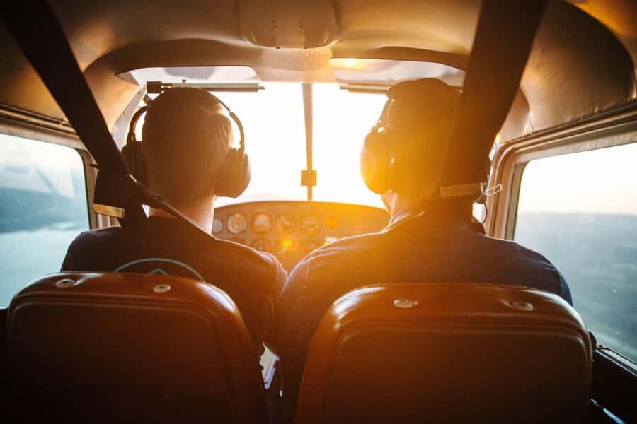
This is a small group flight limited to 9 participants, so it won’t feel like a busy cattle-car tour. The smaller cabin size generally makes the commentary easier to track. You’re also more likely to feel relaxed because you’re not coordinating with a large crowd.
You’ll get commentary from a local guide, and English audio is included. That’s helpful because the flight is fast: you can’t stop to read plaques or ask follow-up questions for long. Having guide commentary built into the experience keeps you from guessing what you’re looking at.
Based on review feedback, the ride quality matters too. Multiple people highlight that the flight felt smooth and that the pilot was great, which is exactly what you want when you’re paying for a short aerial experience. If you’re prone to motion sensitivity, a smooth pilot is a real plus.
Price and value: is $178 worth it?
At $178 per person for a 45-minute scenic flight, you’re paying for a bundle: time savings, aerial access, and structured interpretation. On paper, it’s a lot for less than an hour. In practice, the value depends on what you’re trying to accomplish in Auckland.
If you want both the water (Waiheke and the gulf) and the city (Sky Tower, Harbour Bridge) in one outing, $178 can be fair. A full-day combo tour that gets you similarly oriented on the ground is usually longer, requires more transit, and still won’t give you crater-level volcano views.
Also, the flight is commentary-led and includes English guidance. For me, that turns the experience into more than “seat + views.” You’re learning what you’re seeing as you see it, which is what makes the time feel productive.
What’s not included is food and drinks, so you shouldn’t treat this like a long day with snacks. Plan to eat before you go, especially because the experience is short and the main event is the flight itself.
Booking smart: when to schedule your flight
Weather is a big factor in flying in the Auckland region, and this flight only operates when conditions allow a safe and enjoyable experience. If your trip is canceled due to weather, your booking can be rolled to the next available flying day.
My best practical tip: schedule your flight as early as you can in your Auckland/Waiheke stay. That gives you maximum flexibility to move to a later day if the first attempt doesn’t work.
You’ll also want to arrive at least 10 minutes early for check-in and the safety briefing. It’s not long, but if you cut it close you’ll feel rushed before you even take off.
One more detail I respect: you must provide individual traveler weights when booking. The limit is 110 kilograms (242 pounds), and people over 243 lbs (110 kg) aren’t suitable. If you’re near the cutoff, it’s worth contacting the local partner after booking.
What to bring (and what to leave behind)
Bring a passport or ID card, plus comfortable shoes and clothes. The temperature in the plane will be similar to outside, so dress for the weather rather than assuming the cabin will be warm.
Leave luggage and large bags behind. They aren’t allowed, and you’ll also want to skip selfie sticks. If you’re traveling light already, great—this activity fits that style of planning.
If you’re the type who likes to bring a camera, keep it manageable. The goal is to enjoy the views without turning the flight into a packing-and-gear session.
Who this Auckland flight is best for
This is a strong fit for you if you want a fast orientation to Auckland and the Hauraki Gulf. It’s also ideal if you don’t want to spend hours commuting between viewpoints, ferries, and tours.
It’s especially good if you like clear, structured sightseeing. The route is set: Waiheke → islands → downtown Auckland → Sky Tower → Harbour Bridge and coast → North Head → Rangitoto crater → back to Waiheke. You’re not wondering what’s next.
You might not love it if you need lots of downtime during the activity or if weather changes would be a major inconvenience for your schedule. But if you can plan with flexibility, this flight gives you an efficient, memorable aerial snapshot.
Should you book this scenic flight?
I’d book this if you’re trying to get the “Auckland story” in one short outing: island scenery, city icons, and a real crater view. For the money, the value is in the combination—Waiheke’s coastline and vineyards, Auckland’s skyline photo pass, and Rangitoto’s crater all in 45 minutes with English guidance.
I’d hesitate only if your schedule is rigid and you can’t shift plans if weather cancels the flight. In Auckland, that risk is real, and this experience depends on it.
If you can travel with some breathing room, this is one of those activities that tends to make your whole trip make more sense once you land—because the aerial views connect the pieces.
FAQ
How long is the Auckland City & Hauraki Gulf Scenic Flight?
The flight duration is 45 minutes.
How much does it cost?
It costs $178 per person.
What’s included in the ticket price?
You get the 45-minute scenic flight plus commentary from a local guide. An English audio guide is included as well.
What should I bring?
Bring a passport or ID card and wear comfortable shoes and clothes. Dress for the weather since the plane temperature will be similar to outside.
Are food and drinks included?
No, food and drinks are not included.
Where is the meeting point?
The meeting point may vary depending on the option you booked. Check your confirmed details after booking.
What items aren’t allowed?
Luggage or large bags aren’t allowed, and selfie sticks are not allowed.
What’s the group size?
The group is limited to 9 participants.
What happens if weather cancels the flight?
If conditions don’t allow the flight, your booking can be rolled to the next available flying day.
Can I cancel for a refund?
Yes. You can cancel up to 24 hours in advance for a full refund.